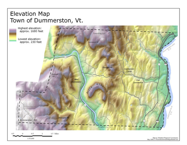
A hypsometric map shows elevation within a specific geographical location by means of contouring, shading, and tinting. This is a hypsometric map of Vermont. The different colors and shading represent an array of elevations throughout the map while the contours give it realistic texture.
No comments:
Post a Comment